
Madagascar Geography and Maps


With an area of 587,041 square kilometres, Madagascar is the fourth largest island in the world. It is located in the Indian Ocean right off the coast of southeastern Africa and is known as “The Great Red Island” because of the red soil found there. The geography of Madagascar can be divided into five regions: the East Coast, the Central Highlands, the Tsaratanana Massif, the West Coast and the Southwest.
The East Coast is an area of lowlands leading to steep bluffs and the central highlands. The Canal des Pangalanes is one of the longest canals in the world and is a feature of the coast. Built by the French between 1896-1904, it is used mainly for transportation and fishing but also hosts unspoiled beaches that are favourites amongst tourists.
The Central Highlands contain a wide variety of topographies including rounded and eroded hills, extinct volcanoes and alluvial plains and marshes. The Central Highlands also include the Anjafy High Plateau, Lake Itasy which is in a volcanic crater and the Ankaratra Massif - the last remaining area of high forest in central Madagascar.
The Tsaratanana Massif is located at the north end of the island. It houses Maromokotro, the highest peak in Madagascar at 2,876 m (9,436 ft) as well as other mountains of volcanic origin.
The West Coast has many protected harbours as well as broad plains. These protected harbours attracted explorers, traders and pirates from Europe, Africa and the Middle East. The plains are believed to have strong agricultural potential but the area is not heavily inhabited. There are mangrove swamps in the area that have remained largely unexplored.
The Southwest part of the country is characterized by the Mahafaly Plateau and a desert region. It is bordered on the east by the Ivakoany Massif and to the north by the Isala Roiniforme Massif.
Madagascar Travel Information
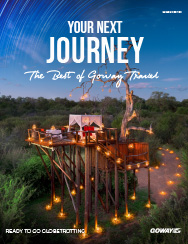
At Goway we believe that a well-informed traveller is a safer traveller. With this in mind, we have compiled an easy-to-navigate travel information section dedicated to Madagascar.
Learn about the history and culture of Madagascar, the must-try food and drink, and what to pack in your suitcase. Read about Madagascar's nature and wildlife, weather and geography, along with 'Country Quickfacts' compiled by our travel experts. Our globetrotting tips, as well as our visa and health information, will help ensure you're properly prepared for a safe and enjoyable trip. The only way you could possibly learn more is by embarking on your journey and discovering Madagascar for yourself. Start exploring… book one of our Madagascar tours today!
Extend Your Trip
After your Madagascar tour, why not consider one of Goway's Europe Tours
Book your Madagascar tour with Goway!
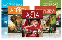
 AfricaExperts is the exclusive division of Goway that specializes in planning and organizing Madagascar tours and experiences. Choose from one of our small group tours and more. We want to be your first choice when next you go globetrotting to Madagascar.
Get a Trip Quote Order a Brochure